
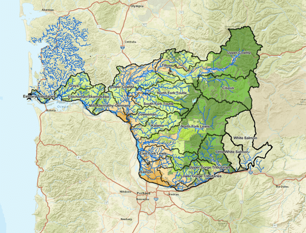
Visit the Salmon Resource Map
The Lower Columbia Salmon Resource Map is designed to inform habitat restoration, conservation and programmatic actions by Tribes, state agencies, counties, restoration practitioners, conservation organizations, landowners and other interested parties. Map resources build on the All-H recovery scenario in the Washington Lower Columbia Salmon Recovery and Fish & Wildlife Subbasin Plan.
Click on the map image below to start exploring.


Recent Updates
Historical Splash Dam Locations
This data layer centralizes historical splash dams located on lower Columbia River tributaries across southwest Washington. The majority of splash dam sites in this data set are coarse-scale estimates based on hand-drawn maps. The long-term habitat impacts from these splash dams can still be seen today in the form of bedrock-dominated and incised channels, and disconnected floodplains. Habitat restoration treatments in these watercourses are often focused on adding large wood to capture spawning gravels, reestablish habitat complexity, and reconnect adjacent floodplains and wetlands. Reestablishing and protecting functional riparian habitat are also critical to supporting a long-term supply of woody material in streams with splash dam legacy impacts.
Fish Passage Inventory and Priority Data Layers
A regional barrier inventory and prioritization project was completed in summer 2025, and the first update (version 2) was completed in May 2026. Data layers include fish passage barrier locations, barrier passage status, and priorities for passage improvement based on salmon recovery needs region-wide.
Learn more about the Lower Columbia Barrier Inventory and Decision-Support Tool and read the project report.
Check out the Lower Columbia Barrier Quick Guide to learn how to access and interpret this new information, or watch the recording from our October 2025 barrier funding workshop.