Fish Passage
Learn More About the Project
The Lower Columbia Estuary Partnership and Fish Recovery Board partnered with a technical advisory group to develop a centralized barrier inventory and decision-support tool that prioritizes barriers for fish passage improvement to ensure limited resources maximized passage improvement benefits for Endangered Species Act listed salmon and steelhead. A GIS model was designed to generate scores for fish passage barriers that:
- 1. block habitat for the highest number of populations of importance for species-scale recovery;
- 2. block a large quantity of high-quality habitat for these species; and
- 3. are accessible to salmon and steelhead from downstream (i.e. lack a total barrier downstream which would prevent access by salmon).
Higher scores indicate higher priority barriers for passage improvement. Barriers identified as Tier 1 and Tier 2 barriers have the highest scores in the region.
The barrier inventory will be updated each winter, and priorities will be re-calculated based on newly available information. Version 2 was released in May 2026.
Access Data
Learn more about the project on the Estuary Partnership’s project page.
Check out the barrier quick guide.
Access barrier data on the Salmon Resource Map.
Read the project report.
Planning a Fish Passage Project?
Barrier priorities do not reflect current land use, landowner support, or feasibility of correcting barriers. It is essential to visit sites to better understand on-the-ground conditions. If you have questions about the barrier data or are considering proposing a project, reach out to .(JavaScript must be enabled to view this email address).
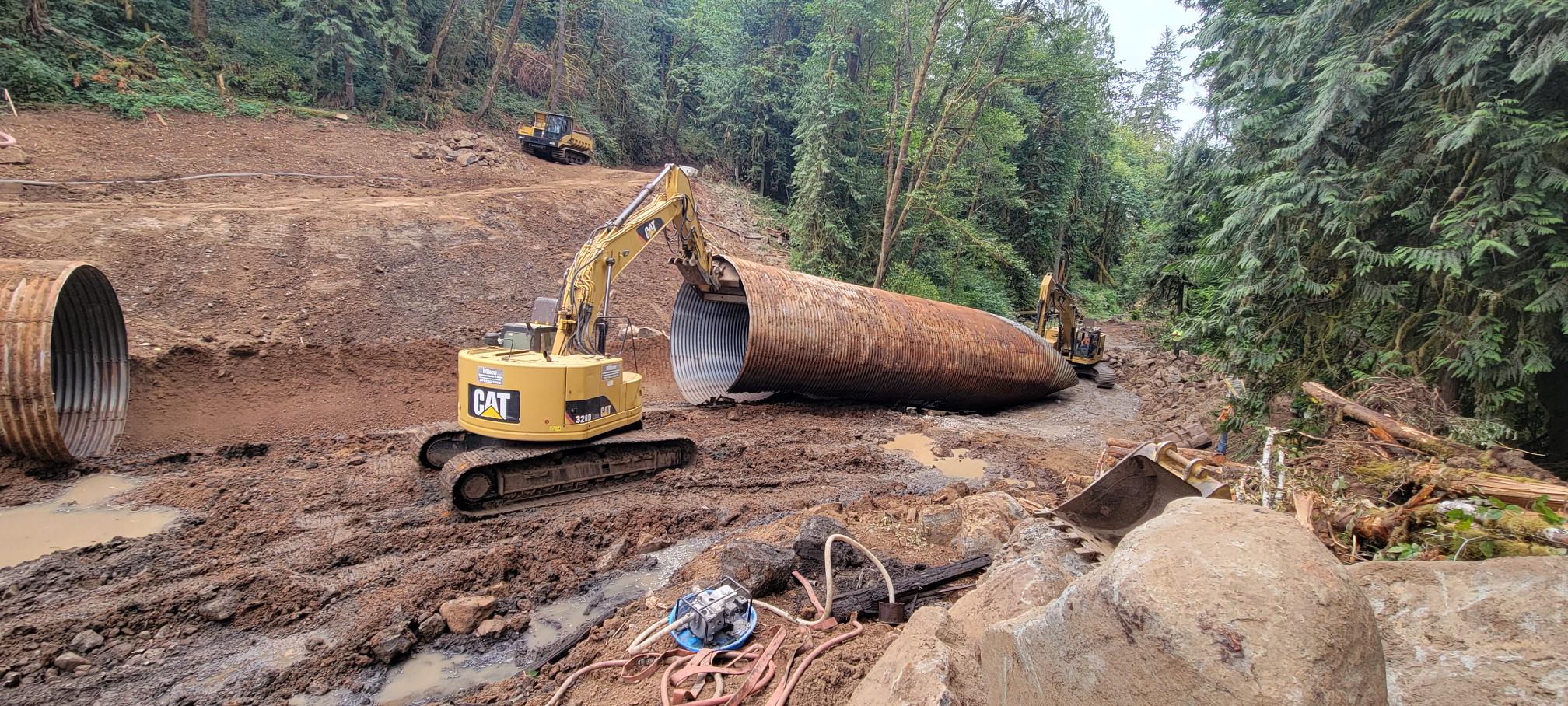
The Cowlitz Indian Tribe provided access to over 9 miles of salmon and steelhead habitat by removing an undersized culvert in Ostrander Creek. This barrier was flagged as a high priority (Tier 2) fish passage correction in the initial prioritization run for the regional barrier project. The Cowlitz Indian Tribe project builds on downstream fish passage improvements by Cowlitz County and upstream projects completed under the State’s Road Maintenance and Abandonment Plan (RMAP) program.